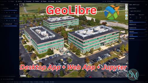
GeoLibre is a free and open source GIS platform built for visualizing, exploring, analyzing, and sharing geospatial data. What makes it especially interesting is its flexible approach to deployment. The same workspace can run in a web browser, as a desktop application, on mobile devices, and inside Jupyter notebooks. It also emphasizes local processing and privacy, making it an appealing alternative to heavier traditional GIS applications.
GeoLibre is aimed at users who work with maps and spatial data but do not necessarily want to install a large desktop GIS application. The browser version runs entirely client-side, with loaded data processed locally in the browser session. There is no required account or server backend for normal use.
Under the hood, GeoLibre combines MapLibre GL JS, DuckDB-WASM Spatial, deck.gl, React, TypeScript, and Tauri. This combination gives it a modern foundation for handling both traditional geospatial files and newer cloud-native formats.
Key Features of GeoLibre
Browser-Based GIS
GeoLibre can run directly in a modern browser without installation. Users can load supported vector and raster data, create maps, style layers, and perform spatial analysis without setting up a dedicated GIS workstation.
Desktop and Mobile Support
For workflows requiring filesystem access and native functionality, GeoLibre is also available as a desktop application for Windows, macOS, and Linux. The same project format can move between different versions of the application.
Cloud-Native Geospatial Data
One of GeoLibre's strongest areas is its support for modern cloud-native formats and services. It can work with GeoParquet, FlatGeobuf, PMTiles, COG, Zarr, vector tiles, GeoJSON, WMS, and other remote datasets.
This approach can be particularly useful when working with large datasets where downloading everything locally is unnecessary.
Spatial SQL
GeoLibre includes a SQL Workspace powered by DuckDB Spatial, allowing users to query and analyze spatial data using SQL. It also supports additional spatial engines, including PGlite with PostGIS and Apache Sedona.
Geoprocessing Tools
The application goes beyond simple map visualization. Its processing capabilities include vector analysis, raster processing, spectral indices, georeferencing, spatial statistics, network analysis, and conversion between geospatial formats.
3D and LiDAR
GeoLibre supports 3D Tiles, terrain visualization, and LiDAR datasets, making it useful for users working with 3D geographic information rather than only conventional 2D maps.
Plugin System
The platform includes a plugin API and plugin marketplace, allowing functionality to be extended without modifying the core application. This provides room for specialized workflows and third-party integrations.
Privacy-Focused Architecture
GeoLibre Web processes data locally in the browser and does not require an account or analytics for normal usage. Data only leaves the browser when users deliberately connect to remote resources or share a project.
Download GeoLibre v3.8.0 - Software Mirrors |
|---|
GeoLibre v3.8.0 for WindowsGeoLibre.Desktop_3.8.0_x64_en-US.msi | 43.64 MB GeoLibre.Desktop_3.8.0_x64-setup.exe | 42.63 MB geolibre-desktop_windows_x64.exe | 47.71 MB geolibre-desktop-3.8.0-x64.msix | 43.38 MB geolibre-desktop-3.8.0-x64-portable.zip | 43.3 MB geolibre-chrome-0.4.0.zip | 51.07 kB |
GeoLibre v3.8.0 for macOSGeoLibre.Desktop_3.8.0_x64.dmg | 45.64 MB GeoLibre.Desktop_3.8.0_universal_mas.pkg | 113.62 MB GeoLibre.Desktop_3.8.0_aarch64.dmg | 44.97 MB geolibre-desktop_darwin_x64 | 48.8 MB geolibre-desktop_darwin_aarch64 | 48.22 MB |
GeoLibre v3.8.0 for LinuxGeoLibre.Desktop_3.8.0_amd64.deb | 44.46 MB GeoLibre.Desktop_3.8.0_amd64.AppImage.zsync | 211.78 kB GeoLibre.Desktop_3.8.0_amd64.AppImage | 120.84 MB GeoLibre.Desktop-3.8.0-1.x86_64.rpm | 44.47 MB geolibre-desktop_linux_x64 | 51.06 MB |
GeoLibre v3.8.0 for Androidgeolibre-android.aab | 175.44 MB geolibre-android-x86_64.apk | 54.05 MB geolibre-android-x86.apk | 54.13 MB geolibre-android-arm64.apk | 52.95 MB geolibre-android-arm.apk | 49.14 MB |
GeoLibre v3.8.0 for iOSGeoLibre_3.8.0_ios_app-store.ipa | 45.77 MB |
Others Download related to GeoLibre v3.8.0GeoLibre.Desktop_3.8.0_x64.app.tar.gz | 44.73 MB GeoLibre.Desktop_3.8.0_aarch64.app.tar.gz | 44.06 MB |
GeoLibre v3.8.0 Source Code
GeoLibre v3.8.0 Source code (zip)
GeoLibre v3.8.0 Source code (tar.gz)
|
GeoLibre v3.8.0 Release Notes: GeoLibre v3.8.0 brings complete QGIS and QField projects, Bluetooth GNSS with RTK corrections on Android, and much richer STAC and Planetary Computer search. You can now import a QField-ready project with its forms, symbology, and linked tables, survey with a centimeter-grade rover straight from the Android app, search imagery by any shape with a cloud cover cap, and start Model Builder from ready-to-run samples. It brings together 58 pull requests from 10 contributors, 8 of them contributing for the first time. Thank you to everyone who helped!
Highlights
- QGIS and QField projects, complete: importing a QGIS project now brings each layer's attribute form (Value Map, Range, Checkbox, Date/Time, and UUID widgets, Value Relation and Relation Reference dropdowns, aliases, required fields, defaults, sections, and photo fields) and its categorized, graduated, and rule-based symbology. GeoPackage tables without geometry come in as table layers, and relation dropdowns read them live, so a project prepared for QField collects data the same way in GeoLibre. See Projects.
- Bluetooth GNSS and RTK on Android: the Android app connects to a paired Bluetooth GNSS receiver directly and feeds it RTK corrections from an NTRIP caster (NTRIP 1.0 and 2.0, optionally over TLS). The corrections go straight to the receiver, so a survey-grade rover needs no second app. See GPS Tracking.
- STAC search by shape: the STAC browser searches by a drawn point, line, or polygon, a selected feature, or a file, with an optional buffer. Results sort by date, a Max cloud filter keeps hazy scenes out, and items can be added with band renderings. See STAC Catalogs.
- Planetary Computer, connected: the panel adds date-range mosaics, restyles layers after they are added, identifies pixel values, and turns search results into a Time Slider stack with a pixel time series. Python and the MCP server can author Planetary Computer layers, and AI Assistant layers now show up in the panel. See Planetary Computer.
- Earthdata GIS: results load as you scroll, and an image service's card picks one of its published raster functions (such as NDVI), which you can switch on a layer already on the map. See Earthdata GIS.
- Model Builder samples: a Samples menu opens six ready-to-run workflows, from DEM stream networks and Strahler order to terrain derivatives, contours, and route stations near cities, each with its sample data. See Model Builder.
- AI Assistant and plugins: TrustedRouter joins the AI providers, and a managed deployment can switch on keyless Parallel web search. Plugins can read files shipped in their own bundle with
app.readPluginAsset() and send headers such as Authorization for tiles they draw themselves with app.setUrlRequestHeaders(). See AI Assistant and the Plugin API.
- Fixes: quick filters count values across the whole layer, saved projects reopen in 3D with their terrain look, Zarr layers redraw on reopen, ArcGIS ImageServer source rasters draw and identify pixel values, story map chapter fades keep layer styles, and more than 110 Whitebox tools now reach Model Builder.
Download
Launch GeoLibre Web at https://web.geolibre.app, or get the desktop and mobile apps from https://geolibre.app/downloads/ (or the assets below).
What's Changed- feat(assistant): add TrustedRouter as a provider by @jperla in #3379
- fix(3d-tiles): ground I3S scene layers with absolute heights on a flat map by @giswqs in #3376
- fix(python): file ArcGIS SceneServer URLs from add_3d_tiles as I3S layers by @giswqs in #3378
- Add readPluginAsset app API for plugin-bundled assets by @zhengqiuyang in #3301
- fix(geo-editor): place edge markers on their edges' midpoints by @giswqs in #3383
- feat(assistant): add opt-in keyless Parallel web search by @georgeatparallel in #3380
- feat(stac): search by shape, date sort, cloud cover, buffer, and band renderings by @ianhorn in #3381
- chore(deps): bump anthropics/claude-code-action from 1.0.266 to 1.0.269 in the actions-minor-patch group by @dependabot[bot] in #3385
- chore(deps): bump @google/genai from 2.32.0 to 3.0.0 by @dependabot[bot] in #3387
- chore(deps): bump the cargo-minor-patch group in /apps/geolibre-desktop/src-tauri with 2 updates by @dependabot[bot] in #3384
- chore(deps): bump the npm-minor-patch group with 33 updates by @dependabot[bot] in #3386
- fix(navigation): move to the next unit when a distance rounds up to it by @kevin9327 in #3389
- fix(imdf): style units with a categorized renderer the Style pane shows by @giswqs in #3390
- fix(processing): type generic WASM outputs so 110+ Whitebox tools reach Model Builder by @giswqs in #3392
- feat(model-builder): add a Samples menu of ready-to-run workflows by @giswqs in #3391
- fix(desktop): explain Flatpak sandbox when dropped files are unreadable by @giswqs in #3394
- feat(assistant): add UberLLM as a provider by @PSA-Team-source in #3396
- feat(gps): connect Bluetooth GNSS receivers in the Android app by @giswqs in #3399
- feat(gps): feed NTRIP RTK corrections to a Bluetooth receiver on Android by @giswqs in #3401
- feat(qgis): import form setup from QGIS/QField projects by @giswqs in #3403
- feat(qgis): import categorized, graduated and rule-based symbology by @giswqs in #3404
- feat(qgis): tables, linked records, photo fields and form sections by @giswqs in #3405
- feat(plugins): send request headers for a URL prefix a plugin draws itself by @TheSylex in #3406
- fix(legend): show values that round to 1,000.0K as 1.0M by @cpruijsen in #3407
- fix(terrain): keep the map center clamped to the ground so zoom is not capped over high terrain by @giswqs in #3411
- fix(attribute-table): constrain long cell values by @JPPereira93 in #3410
- feat(earthdata-gis): load more results on scroll by @giswqs in #3413
- feat(earthdata-gis): pick an image service's raster function by @giswqs in #3414
- fix(arcgis): draw ImageServer source rasters and identify pixel values by @giswqs in #3412
- docs: even out the homepage feature card lengths by @giswqs in #3415
- feat(planetary-computer): mosaics, restyle, Identify, Time Slider stacks, and Python/MCP authoring by @giswqs in #3417
- fix(dashboard): show cells and sort rows in the List widget by @giswqs in #3418
- fix(storymap): keep layer styles in chapter fades, show the title on the start view by @giswqs in #3422
- fix(vector): smart styling for Add Vector Layer layers by @giswqs in #3421
- fix(zarr): draw a reopened project's Zarr layers on MapLibre by @giswqs in #3425
- fix(about): wrap long link URLs so the dialog never scrolls sideways by @giswqs in #3429
- fix(project-history): redraw a layer restored from a snapshot by @giswqs in #3420
- fix: reopen saved projects in 3D (LiDAR camera reset, terrain look not saved) by @giswqs in #3427
- fix(url): drop the compact z/lat/lon token when syncing the live view by @giswqs in #3428
- fix(url): reject decoded delimiters in compact coordinate keys by @giswqs in #3431
- fix(plugins): honor the FlatGeobuf panel's Layer Name field by @giswqs in #3430
- fix(attribute-table): keep the selection when opening the table by @giswqs in #3432
- fix(selection): keep selection panels inside a shrunken map area by @giswqs in #3433
- fix(layers): keep the feature selection when layer actions activate a layer by @giswqs in #3437
- fix(viewer): skip the leave-site prompt where saving is unavailable by @giswqs in #3435
- fix(sun): let the Sun panel's date field take a typed year by @giswqs in #3434
- fix(lidar): reset the LiDAR panel's Color By and picking on project open by @giswqs in #3436
- chore(deps): bump maplibre-gl-raster to 0.14.18 by @giswqs in #3440
- fix(zarr): point the sea surface temperature sample at a land-masked store by @giswqs in #3441
- fix(quick-filters): count values across the whole layer, not the first 5,000 features by @giswqs in #3419
- fix(attribute-table): offer to embed attribute edits on URL-backed layers by @giswqs in #3423
- fix(share): stop logging the hosted server's optional-route 404s by @giswqs in #3438
- fix(search): frame a picked place by its bounding box by @giswqs in #3424
- Revert "feat(assistant): add UberLLM as a provider (#3396)" by @giswqs in #3442
- perf(quick-filters): profile fields lazily, off the render path by @giswqs in #3443
- fix(quick-filters): honor exclude with explicit fields; drop a dead guard by @giswqs in #3444
- i18n: translate 135 new strings in all 20 locales by @giswqs in #3446
- docs(workshops): restructure the NGIS 2026 workshop into eight new sections by @giswqs in #3439
- chore(release): v3.8.0 by @giswqs in #3447
New Contributors- @jperla made their first contribution in #3379
- @zhengqiuyang made their first contribution in #3301
- @georgeatparallel made their first contribution in #3380
- @ianhorn made their first contribution in #3381
- @kevin9327 made their first contribution in #3389
- @PSA-Team-source made their first contribution in #3396
- @TheSylex made their first contribution in #3406
- @cpruijsen made their first contribution in #3407
Full Changelog: v3.7.0...v3.8.0 |
Performance and User Experience
GeoLibre feels considerably lighter and more modern than many traditional GIS applications. The browser-first design makes it easy to open the application and start exploring data without spending time configuring a large desktop environment.
The use of DuckDB-WASM Spatial is particularly interesting for local analytical workloads, while MapLibre and deck.gl provide a modern foundation for rendering maps and 3D information.
The project is also developing quickly. The current stable release has expanded considerably beyond simple mapping, adding project files, plugins, processing tools, cloud integrations, 3D capabilities, and spatial SQL.
That rapid development is both a strength and a consideration. Users looking for the mature ecosystem and extensive tooling of established GIS software may still prefer QGIS for complex professional workflows.
Pros
Free and open source.
Runs in the browser, desktop, mobile, and Jupyter.
Local-first approach to data processing.
Modern cloud-native GIS support.
Powerful spatial SQL capabilities.
Supports raster, vector, 3D, and LiDAR data.
Extensive geoprocessing tools.
Plugin marketplace and API.
Modern and lightweight interface.
MIT licensed.
Cons
Still much younger than established GIS platforms.
Ecosystem is smaller than QGIS.
Some advanced GIS workflows may still require traditional desktop software.
Rapid development can mean features and interfaces change quickly.
Users unfamiliar with cloud-native geospatial formats may need some time to understand the workflow.
Who Should Use GeoLibre?
GeoLibre is a strong choice for GIS professionals, researchers, developers, students, data scientists, and organizations working with modern geospatial datasets.
It is particularly appealing if you want a GIS application that can work directly with cloud-native data, perform analysis locally, and remain accessible through a browser without requiring a traditional desktop installation.
Developers should also find the combination of TypeScript, React, DuckDB, MapLibre, deck.gl, and Tauri interesting for building customized geospatial workflows.
Final Verdict
GeoLibre is an impressive modern take on GIS software. Instead of trying to reproduce every feature of established desktop GIS applications, it focuses on browser-based workflows, local processing, cloud-native datasets, spatial SQL, modern visualization, and portability.
Its rapid development is perhaps its biggest advantage. The project has grown quickly from a lightweight mapping application into a much broader GIS platform with raster processing, LiDAR, 3D Tiles, spatial databases, plugins, and AI-assisted geospatial functionality.
It is not yet a complete replacement for QGIS in every professional workflow, but GeoLibre is already a compelling option for anyone interested in lightweight, private, and modern GIS software.
Post a Comment/Report Broken Link: